Satellite EO
UAWOS combines satellite EO data with UAS hydrometry datasets to enhance the value of satellite EO data and develop new data products from satellite EO datasets.
- Validation of inland water level services based on Copernicus and other satellite altimetry missions such as Sentinel-3, ICESat-2, SWOT, Sentinel-6, etc. This is described in detail here.
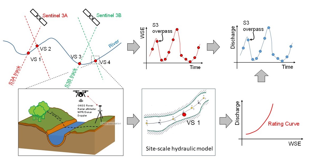
- Conversion of water surface elevation time series at virtual station into river discharge estimates. This will be achieved through one-off or time-lapse surveys of virtual stations using UAS hydrometry surveying workflows. The concept is illustrated in the above figure and details are discussed here. An application of the concept to the Torne River is here.