Surveying workflows

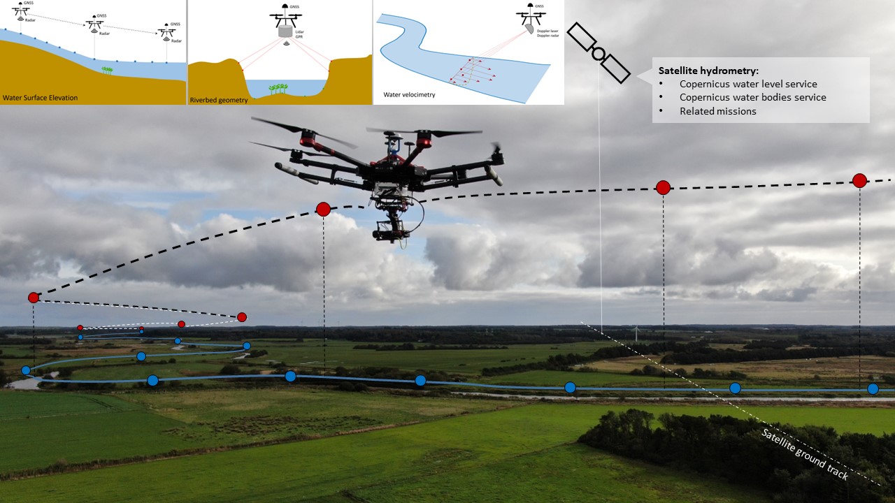
UAWOS develops airborne surveying protocols and standardized workflows for
- Water surface elevation (WSE) in lakes and along rivers. The data can be used to establish hydraulic gradients in remote and poorly monitored areas (example), to map conveyance changes along rivers (example) and to constrain spatial variation of river hydraulic properties using hydraulic inverse modeling (example).
- Riverbed elevation. The data can be used to parameterize hydraulic river models (example), as an input to river discharge estimation (example), to control shape and conveyance of rivers and streams (example), and to monitor and control deposition and erosion processes in dynamic river environments.
- River velocimetry. The data can be used as an input to river discharge estimation (example), for validation of hydraulic models and for flood risk assessment.
- River discharge. Water surface slope, riverbed elevation and river velocimetry can be combined to estimate river discharge through a cross section and to jointly estimate discharge and hydraulic roughness parameters (example).